Exploring the Uplands of Uozu, Japan

Discover the rich mountain landscapes of Uozu City, from scenic hiking areas and waterfalls to peaceful forests and seasonal natural attractions.

Katakai River

Katakai River

Japan’s Fastest-flowing River

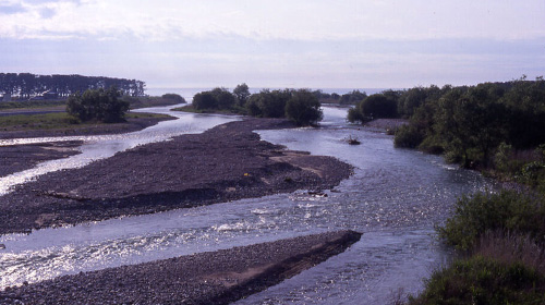
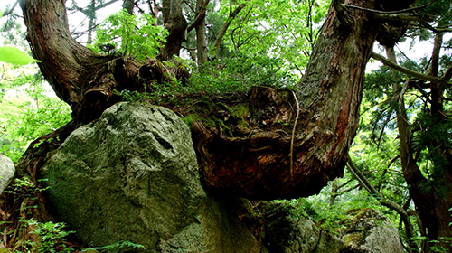
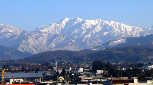
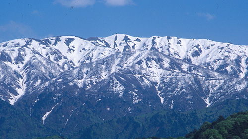
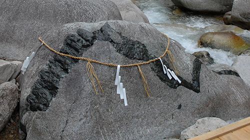
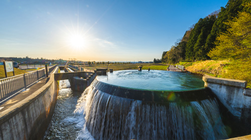
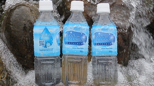
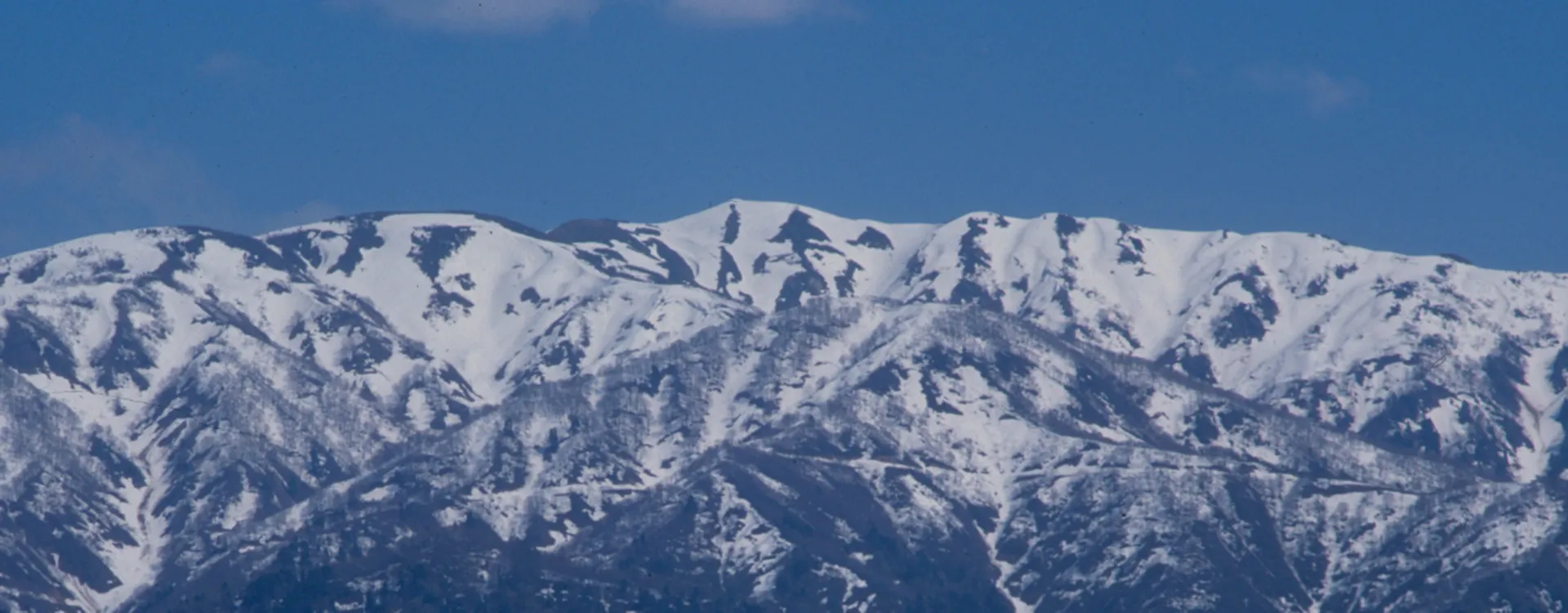
Katakai River is one of Toyama Prefecture’s seven major rivers. Its name is said to derive from the terrain, in which only one side forms a gorge. Originating in the Kekachi Three Peaks of the Northern Alps, it is a Class B river that flows into Toyama Bay and measures approx. 27 km in length. It is one of Japan’s fastest-flowing rivers and has repeatedly caused floods since ancient times. The Minamata Valley is home to a forest of giant Tateyama cedars known as Dosugi. The river basin is popular for mountaineering and nature observation, while the lower reaches are used for agriculture and industry. Areas of spring water can also be found near the river mouth.

Dosugi Cedar / A Cluster of Dosugi Cedars

Dosugi Cedar / A Cluster of Dosugi Cedars

Big Trees with Gigantic Stones; A Power Spot of Uozu

Dosugi are ancient, giant Japanese cedar trees that have grown naturally. The name Dosugi means “hollow cedar”, as many have hollow cavities within their trunks. Dosugi grow on steep slopes and ridgelines at elevations of around 500m to 700m in the Minamata Valley of the Katakai River. They are often found in areas with many stones and rocks, and more than 124 trees have been confirmed to date. Their age is thought to range from several hundred years to about 1,000 years for the oldest specimens. Their distinctive appearance—standing as if embracing massive rocks—creates a rare and valuable natural landscape.

Mt. Kekachi

Mt. Kekachi

Mt. Kekachi, a Beautiful Peak Forming Part of the Tateyama Mountain Range. Popular with Climbers. Listed among the 200 Famous Mountains of Japan.

Mt. Kekachi is a mountain located on the border between Uozu City and Kurobe City in Toyama Prefecture, and is one of the Kekachi Three Peaks. The Kekachi Three Peaks consist of Mt. Kekachi (2,415 m), Mt. Kamatan (2,415 m), and Mt. Nekomata (2,378 m), and they form the headwaters of the Katakai River. Mt. Kekachi is popular with climbers, and many people ascend it during the late snow season from May to June. Climbing routes include Abuki Valley, Nekomata Valley, and Higashimata Valley. Kekachi Valley features a large snowfield approx. 1,200 m long, with snow remaining until summer. In the past, the mountain could only be climbed during the snow season, but it is now also accessible in summer. However, the climb is technically demanding, and it is dangerous for beginners to attempt it alone. During the snow season, crampons and an ice axe are required. The upper sections are steep, and caution is necessary due to the risk of falling rocks and avalanches.

Mt. Sogadake

Mt. Sogadake

A Spiritual Mountain for Uozu Citizens

Mt. Sogadake (1,855.5 m above sea level) is a mountain visible directly in front of Uozu City, and is beloved by local residents. It is a familiar presence to the extent that people sense the arrival of winter with the first snowfall and feel the coming of spring with the melting snow. The mountain’s name comes from the shape formed by lingering spring snow, which is said to resemble a Buddhist monk playing a shakuhachi flute while leading a horse. In the past, it was also called Mt. Somadake, and it is alternatively known as Mt. Hotokegadake. During the spring thaw, the shapes of a monk and a horse appear in the snow, and it is said that farmers in earlier times used this as a guide to determine the timing of rice planting. Mt. Sogadake is also climbed by many hikers. There are three main climbing routes: the Higashimata Route from Uozu City, the Eboshi Ridge Route from Kurobe City, and the Unazuki Ridge Route.

Hebi-ishi (Snake Stone)

Hebi-ishi (Snake Stone)

A Stone in which a Water God Dwells

Hebi-ishi (Snake Stone), located on the riverbed of Minamata Valley in the upper reaches of the Katakai River, is also known as Ryuseki (Dragon Stone). Black diabase veins intruding into white granite form patterns that look as if a giant snake or dragon is coiled around the stone. It measures approx. 1.5 m in height and approx. 2 m in width.

According to legend, long ago a hunter named Santa discovered a giant snake wrapped around a huge rock. When he fired mysterious bullets of gold and silver said to possess supernatural power, the snake died entwined around the stone amid peals of thunder, and its lingering resentment is said to have caused a great flood. Even today, floods of the Katakai River are feared as the curse of the stone, and during times of drought it is believed that striking the stone will surely bring a thunderstorm with heavy rain.

Katakaiyama-no-mori Campground

Enjoy Nature at a Campground by the Clear Waters of the Katakai River

Located in the upper reaches of the Katakai River within Katakai Prefectural Natural Park, this campground offers auto-camping sites with access to electrical hookups. Surrounded by unspoiled nature, visitors can enjoy barbecues and camping, as well as fishing and playing in the water of the Katakai River flowing right beside the site.

Higashiyama Cylindrical Water Diversion Tank

Higashiyama Cylindrical Water Diversion Tank

Welling Spring of Treasured Water (National Registered Tangible Cultural Property (Structure))

The Higashiyama Cylindrical Water Diversion Tank is a facility that fairly divides water among three irrigation channels: Tenjinno Irrigation Canal, Aoyagi Irrigation Canal, and Higashiyama Irrigation Canal. Owing to its beautiful form and flowing water, it is popular as a sightseeing spot and a so-called “power spot”. In December 2020, a pocket park was developed where visitors can view the tank and its surroundings. Its structure, featuring a large drop in height, is rare, and it has been introduced as “the most beautiful cylindrical diversion tank in Japan.” With a diameter of approx. 9 m, the volume of water is automatically distributed according to the length of the circumference. A key feature is that the water is divided fairly regardless of fluctuations in water volume. In April 2020, it was registered as a National Registered Tangible Cultural Property.

Uozu’s Delicious Water

Uozu’s Delicious Water

Try “Uozu’s Delicious Water”

This drinking fountain was installed by Uozu City to commemorate the 30th anniversary of the city’s incorporation, based on a proposal by the late Professor Ikeda Yasaburo, a scholar of Japanese literature, who praised Uozu by saying, “Uozu’s water is the best in Japan!” The water is warm in winter and cool in summer, smooth on the throat, and highly recommended for its excellent taste. In February 1986, it was selected as one of Toyama’s Famous Waters.

Uozu’s Water Circulation

The Uozu Water Cycle, Completed Within a Single City

Uozu City has a globally rare topography in which the entire water cycle is completed within a single municipality. From sea level (0 m) to mountainous areas exceeding 2,400 m in elevation, everything is contained within a depth of approx. 25 km. This steep terrain continues beneath the sea, reaching depths of up to 1,000 m.

Water evaporates from the sea, falls as rain or snow on the mountains, and eventually returns to the sea. This process is known as the “Uozu water cycle,” and it nurtures a wide variety of living creatures in the mountains, villages, rivers, and sea, while also supporting the lives and industries of the people who live in Uozu.